
Greenfield Previous Residents by Era
No single source covers the full life of a Greenfield address. The best first record depends on the period and whether the question concerns an owner, an occupant, or the building itself. The table separates those jobs and gives every documented access route, including the physical counter and library path where online coverage stops.
| Source | Local span | Access point | Evidence supplied |
|---|---|---|---|
| Recorder deeds | January 1968 forward online | Doxpop; Recorder counter, mail, books, or microfilm | Parties, instrument, date, and legal description |
| Greenfield directories | Selected years, 1905 to 2015 | HCPL, State Library, and 1922 online scan | Names and printed residence lines |
| Federal census | Released schedules through 1950; 1890 mostly lost | HCPL databases and National Archives routes | Households, relationships, ages, and place |
| Sanborn maps | 1886 to 1949 in listed editions | Indiana State Library map collection | Building footprint, use, materials, and street setting |
| Sales disclosures | Public from January 2000 | Auditor and GIS | Transfer and parcel evidence |
| Newspapers | Local runs from 1860 forward | HCPL microfilm and licensed databases | Obituaries, notices, and address clues |
| Probate and wills | Probate after 1828; listed will holdings vary | Clerk, HCPL, and State Library | Estate, heirs, executor, and property clues where public |
Start with Beacon for a current parcel. Use Doxpop for an online deed chain after its cutoff. Earlier deeds require the Recorder's books, microfilm, counter help, or a written copy request. For occupants rather than owners, shift to directory and census evidence. Building age and shape belong to maps and permit files, not to a resident list.
Start With Greenfield Parcel Records
The Hancock County Beacon property search accepts an owner name, property address, or parcel ID. Save the current owner, parcel ID, property or situs address, legal description, and last-transfer date if shown. Keep the owner mailing address in a separate field. A mailing address may be elsewhere, and a situs address does not prove who sleeps at the property now.
The parcel number and legal description are the durable bridge into deeds. Beacon map lines are graphic aids, not legal boundaries, and only a registered surveyor can locate a legal boundary. The public parcel layer may expose an old parcel number, transfer field, subdivision text, and both property and owner ZIPs, but not every service field is necessarily displayed on the parcel card.
If Beacon fails, call the Assessor at 317-477-1102 or GIS at 317-477-1150. The Auditor, at 317-477-1105, handles transfers, sales disclosures, and deduction records. These offices can point to their own records, but the Recorder remains the source for the deed itself.
Trace Greenfield Past Owner Deeds
The Hancock County public records route sends remote users to Doxpop. An account is required, though the county says some searches are free. Index data and scanned images begin in January 1968. Search backward by party role and confirm each result with its instrument, date, legal description, and image or official copy.
- Copy the present owner's name, parcel ID, legal description, and any displayed transfer date from Beacon.
- Find that owner as grantee, the person receiving property, near the transfer date. Match the parcel or legal text.
- Take the seller, or grantor, from the deed and search that person as an earlier grantee. Test initials and spelling variants.
- Repeat the link while noting splits, combinations, lot and block references, and metes-and-bounds text.
- At the 1968 online boundary, move to Recorder books, microfilm, the counter, or a mailed copy request.
- Grantor and grantee
- The grantor transfers an interest; the grantee receives it. The same person changes roles when the chain moves back to an earlier purchase.
- Chain of title
- The linked sequence of transfers for one property. A research chain is not a legal title opinion.
- Legal description
- The lot, block, subdivision, tract, or boundary text that identifies land more reliably than a changing street label.
The Recorder is at 111 S American Legion Place, Suite 202, Greenfield, and is open Monday through Friday from 8 a.m. to 4 p.m. Call 317-477-1142. Copies cost $1 per page. Mail requests need a self-addressed postage-paid envelope and check or money order, and staff do not conduct a title search or give a legal opinion.
Greenfield Recorder Records Stop Online
Online does not mean complete. Hancock's Doxpop index and images start in January 1968. A February 2026 vendor announcement said all document-type indexes from that point became remotely available around the clock, but it did not push coverage into earlier decades. Before the cutoff, use the Recorder counter, deed books, microfilm, plat resources, and a written request.
The manifest capture of the Doxpop county coverage table shows the Hancock start date.
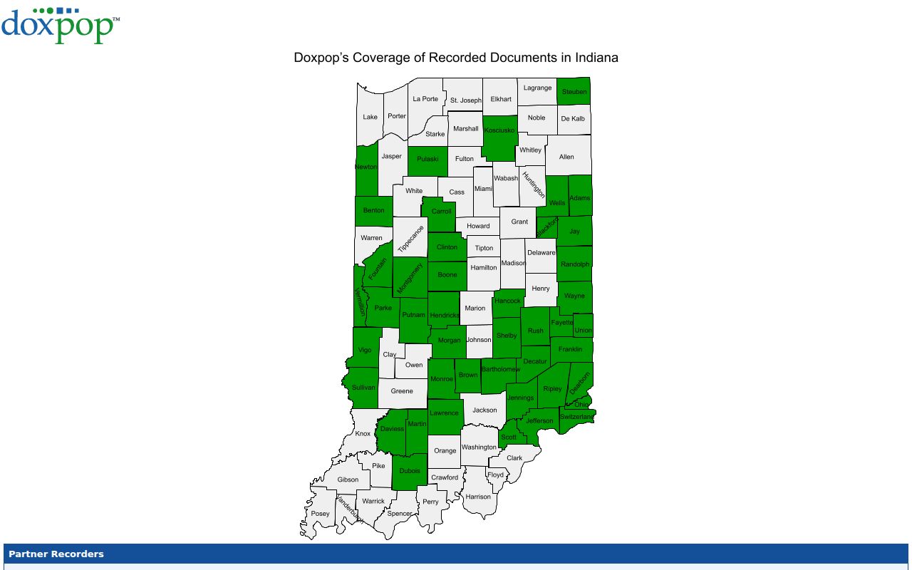
That date is a portal boundary, not the start of Hancock land records. Older instruments remain an office, book, microfilm, library, or archive task.
Local scale. The Recorder reported 14,911 recorded documents in 2025, a document count rather than a count of people or parcels.
Map Greenfield Address Records
The Indiana State Library Sanborn index lists Greenfield sheets for 1886, 1892, 1895, 1900, 1906, 1914, 1927, and 1927 to 1949. Compare editions to see a building footprint, addition, use, construction details, and street context. A map can help date a structure. It does not name previous residents.
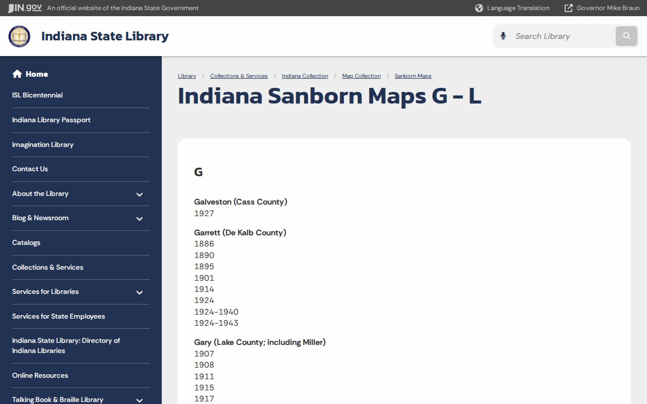
State Library holdings also include city maps from 1955, 1961, 1963, and 1968, plus a 1973 Johnson's city map and street guide. Use those sources to bridge an old street form or subdivision name.
Bridge Greenfield Resident Address Changes
No official source verified a Greenfield street-renumbering year. That gap matters. When an old directory address fails in Beacon, do not invent a renumbering event or force the modern number onto the old household. Compare the printed street guide, a map from the same period, the subdivision plat, the parcel's legal description, and a Recorder instrument.
Annexation and rural-route coverage can also change the label without moving the land. A 1921 county agricultural listing and a four-county Polk edition have different borders from a city-only directory. The modern parcel map shows current geography, not the exact line used by an earlier publisher.
CitizenServe adds a later address and parcel trail for permits, planning matters, and code files. Its public search uses File Type, Address, and Parcel Number. The online start year is not stated, so older paper material should be requested from Greenfield Planning or the city clerk route rather than treated as absent.
A compact trail is: old address to period map, map to plat or legal description, legal description to deed, and deed to the modern parcel. Mark uncertainty until two independent records agree.
Greenfield House History Records
The Hancock County Historical Society house-history advice gives a useful office split: Beacon for current ownership and recent transfer clues, the Auditor for transfer searches, and the Recorder for actual deeds. The society points researchers to the 1983 Hancock County Interim Report and Greenfield Historic Landmarks, but says it is not a government archive and does not keep an extensive genealogy collection.
Hancock County Public Library, 900 W McKenzie Road, fills another part of the trail. Its Local History/Genealogy Room has city directories, maps, newspaper microfilm, vital indexes, cemetery books, census databases, court and probate references, and librarian appointments. Call 317-462-5141. Some databases are licensed for in-library use, so phone or book a librarian before visiting.
There is no formal local house-history guide or published research fee schedule in the reviewed sources. Use the society for context and referrals, then obtain the actual record from the correct county office or library collection.
Confirm Greenfield's Past Households
Owners are only part of the story. Printed directories and released census schedules can identify people associated with an address, including those who did not own it. Greenfield holdings include selected directory years from 1905 through 2015, while federal schedules provide decade snapshots and the 1890 schedule is largely lost. The collection details belong on the Greenfield city directory page.
- Choose the closest available directory year and save the exact name, residence line, page, and volume scope.
- Compare the nearest released census. Account for a different street form, household arrangement, or rural designation.
- Test the next directory year. An absence may reflect a move, death, marriage, missed canvass, or a gap in holdings.
- Use an obituary, cemetery book, death index, probate file, or deed to explain the change. Keep event dates distinct.
Local newspaper runs include Hancock Democrat/Journal from 1860 to 1973, Hancock Republican from 1889 to 1973, and Daily Reporter from 1908 forward. Obituaries may identify relatives, a former address, or cemetery. Probate may connect heirs, an executor, and property where the file is public. Park Cemetery records need care because an older cemetery site was acquired in 1868 and graves or markers were later moved amid early record gaps.
Write the result as a dated sequence, not a list of names. Label each person as an owner, directory resident, census household member, estate party, or reported relative according to the source. That distinction prevents a deed party from being presented as an occupant and keeps a newspaper address from becoming an unsupported ownership claim.
Lawful use. Research Greenfield previous residents for family or house history, and never use a record trail to track, harass, or harm a living person.