
Greenfield ZIP Coverage at a Glance
Official sources consistently connect Greenfield with 46140. City and county offices use it, the post office is listed under it, and inspected Hancock parcel rows return it as the property ZIP. One older postal reference also pairs 46117 with a Greenfield routing label, but that does not establish a second current city code. The live USPS city result was not captured, so the safe course is to verify a specific current address rather than claim an exhaustive list.
| ZIP | Areas Covered | Post Office | Notes |
|---|---|---|---|
| 46140 | Greenfield delivery area and county or rural addresses using the Greenfield mailing name | Greenfield Post Office, 207 N State Street | Verified current connection; delivery area can cross city limits |
| 46117 | Historical routing reference only | No separate current Greenfield office established | Appears in a 2015 bulletin beside “GREENFIELD IN 46140” |
The Greenfield ZIP code directory therefore leads with 46140 but keeps the historical label separate. USPS delivery zones can change and do not match municipal borders by design. Address-level verification is more precise than assuming every place with the same city name lies within one government boundary.
Run Greenfield USPS ZIP Searches
The USPS ZIP Code Lookup offers three useful paths. Use City and State to find current codes recognized for Greenfield. Use Address when a house number and street are known. Use Cities by ZIP to see the postal city names recognized for a code. USPS warns that a postal result does not confirm that a person or business is present at that address.
| Search mode | Fields | Best use |
|---|---|---|
| By Address | Company optional; street required; unit, city, state and ZIP | Confirm the deliverable code for one address |
| By City and State | City and state required | Check the current Greenfield list |
| Cities by ZIP | ZIP required | Check recognized city names for that code |
The manifest capture shows the official lookup controls used for this Greenfield ZIP code directory.
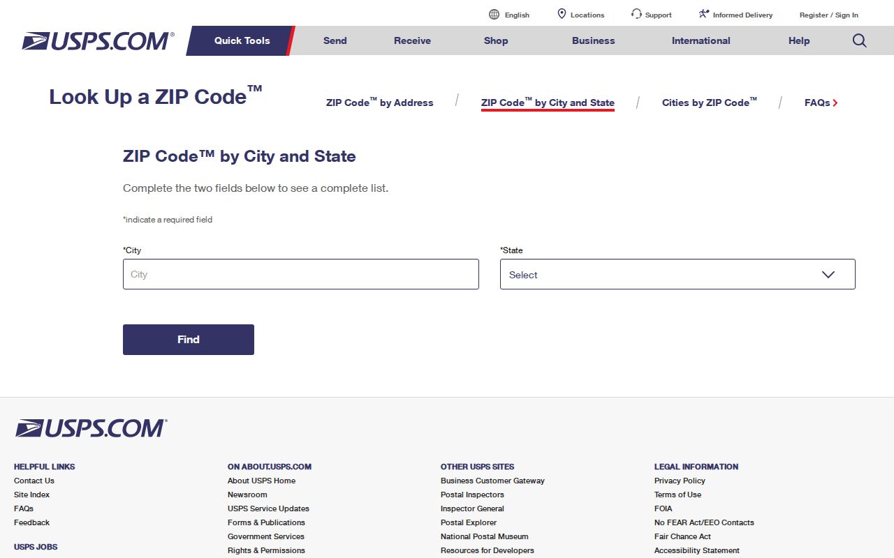
Record the result as postal evidence, then compare it with the parcel and city maps.
Find Greenfield Records by ZIP
A ZIP-wide search is useful for narrowing a large county dataset, but it is not a list of everyone living in the area. The Hancock parcel service can filter physical-property ZIP fields. Indiana Voters, by contrast, offers an individual registration check by county and identity details, not a public downloadable ZIP roster. CitizenServe exposes address and parcel searches, but the inspected form did not show a ZIP field.
- Confirm the postal code through USPS, preferably with the full street address.
- Open Hancock County Beacon or its public parcel layer and use the property ZIP, not the owner mailing ZIP.
- Review the returned parcel number, property street, city label, legal description, current owner fields, and map position.
- Compare the parcel with Greenfield's annexation or zoning map when incorporated status matters.
- Once the set is narrowed, follow the Greenfield street directory for street-level work rather than treating the ZIP as a household roll.
Portal data changes. Save the query date and retain the parcel ID because it is often more stable than a mailing label.
Filter Greenfield Parcels Correctly
The Hancock public parcel layer supports query, statistics, pagination, and geometry with a maximum record count of 2,000. A query for PROP_ZIP='46140' can return property rows, but it follows Hancock parcel geography. It does not automatically clip results to incorporated Greenfield.
| Field | Meaning | Search caution |
|---|---|---|
| PROP_ZIP | ZIP for the physical parcel address | Use for ZIP-based parcel work |
| OWN_ZIP | ZIP for the owner's mailing address | May be far from the parcel |
| PROP_STREE / PROP_CITY | Property street and city label | A postal city label is not a city-limit test |
| PARCEL_ID / OLD_PARCEL | Current and prior parcel keys | Useful when address labels change |
| LEG_DESC | Recorded-style legal description field | Verify against the deed or plat |
| NEIGH_NAME | Assessment neighborhood field | Not necessarily a civic group boundary |
The Greenfield ZIP code directory keeps situs and mailing columns apart. A local mailing code for an owner does not locate the owner's land, and a 46140 parcel does not prove its owner resides on site. Beacon's map lines are also a planning aid, not a legal survey.
Insider tip. Compare PROP_ZIP with OWN_ZIP before drawing any conclusion; those two Hancock fields answer different questions.
Greenfield ZIP and City Limits
Postal routes, municipal boundaries, census areas, voting precincts, and tax parcels are separate layers. The official Greenfield annexation map shows numbered annexation areas and landmarks such as US 40, SR 9, McKenzie, State, Main, Hickory Hill, Fairview Village, and Brandywine. A 46140 mailing address can lie beyond the incorporated city, while a parcel at the edge can carry a rural-looking street.
For a present boundary question, compare USPS address output with the annexation map, city zoning material, and county parcel fields. Greenfield Planning can address the city layer. Hancock GIS or the Surveyor's Office can help with the county map. No separate public E911 readdressing guide was found, so a disputed address should go to those offices rather than to guesswork based on ZIP alone.
Boundary key. A Greenfield postal label routes mail. It does not by itself establish incorporation, voting district, parcel ownership, or legal boundary.
Read Greenfield ZCTAs with Care
Census ZIP Code Tabulation Areas, or ZCTAs, approximate postal areas for statistics. They are built from Census blocks and are not the live USPS delivery boundary. The 2025 Census Gazetteer files provide national ZCTA data based on 2020 Census geography. No local Greenfield city-versus-ZCTA overlay was computed in the research, so a population figure from a ZCTA should not be described as a count of residents within Greenfield city limits.
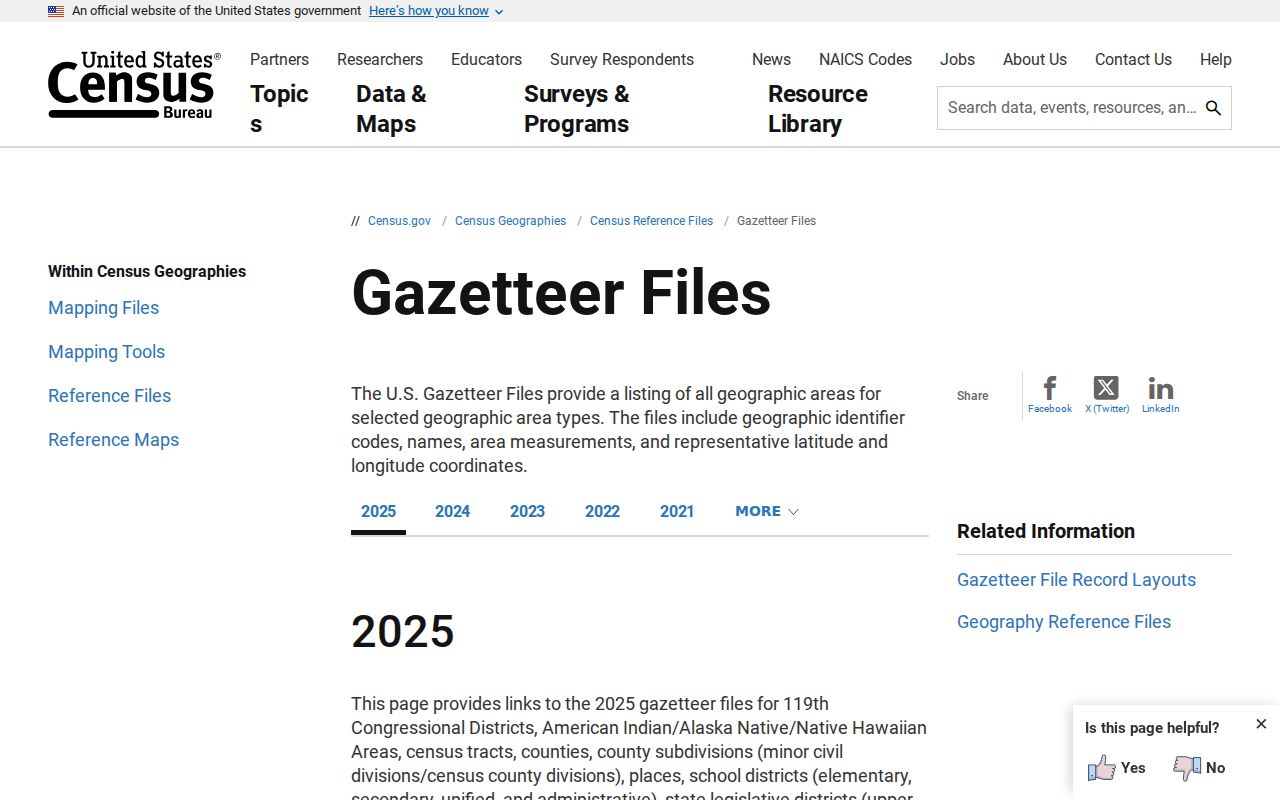
The captured Gazetteer source is useful for broad statistical geography, while USPS and local parcel tools remain the better sources for one address.
- ZIP
- A USPS delivery code, not a municipal boundary.
- ZIP+4
- A finer delivery segment appended to a five-digit code.
- PO-box ZIP
- A code assigned mainly to post-office boxes; none was verified for Greenfield here.
- Unique ZIP
- A code assigned to one large recipient; none was verified locally.
- Carrier route
- A delivery path within a ZIP, not a public resident list.
Greenfield's 46117 Routing Clue
An official 2015 USPS Postal Bulletin contains the pairing “GREENFIELD IN 46140” in material associated with 46117. That is a historical routing or label clue, not proof that 46117 remains a second current Greenfield city ZIP. A 2022 bulletin again uses 46140 in Greenfield-related routing material. Dates matter because old directories, letters, deeds, and newspaper notices preserve the postal rules of their own period.
When 46117 appears on an old Greenfield item, preserve it in the research notes. Search the full street in the USPS address tool, then compare old city maps, directories, and parcel legal descriptions. Do not silently replace the older code. It may help explain why a modern search fails even though the street and family are correct.
Note: The current complete city list still needs a live USPS result, so address-level confirmation remains the sound publication standard.
Bridge Old Greenfield ZIP Addresses
ZIP codes alone cannot solve an old address. Greenfield's 1922 Hoffman directory street guide predates the modern ZIP system, while later directories, 1955 to 1973 maps, and Sanborn sheets help place the street in time. The Recorder's plats and deed legal descriptions can survive a street-name or number change. No official Greenfield street-renumbering year was located, so suspected changes must be checked against original maps and instruments.
Write the historic address exactly as printed before normalizing it. Note the source year, street abbreviation, rural-route label, nearby cross street, and any township or subdivision name. Then check the closest period map. If a modern parcel appears likely, compare its legal description and old parcel field with the Recorder's plat or deed. A matching ZIP alone is weak evidence because postal codes group delivery routes, not a continuous chain of land identity. The library's directory scans and map collection can bridge years that fall before modern parcel systems. Recorder books and plats supply the formal land link. Sanborn sheets can show whether a structure existed during a given period, but they do not identify its residents. Keep postal, map, building, and occupant findings in separate notes until dates and property descriptions agree. When a label remains uncertain, contact USPS for delivery information and Hancock GIS or Greenfield Planning for the relevant local boundary layer. Save every response date because postal and municipal layers can change.
A practical bridge runs from the old directory entry to a period map, then to the subdivision or legal description, and finally to the current parcel. The 1973 Johnson's city map and street guide can help with the later transition. Greenfield Sanborn sheets exist for 1886, 1892, 1895, 1900, 1906, 1914, 1927, and a 1927 to 1949 update run. Those maps show building and block continuity, not present residents.
The ZIP code directory should end with the right scale. Use 46140 to narrow. Use USPS to validate mail. Use Beacon to inspect land. Use the city map to test incorporation. Use deeds, plats, and period directories when the address itself has changed.