
Walk a Greenfield Street Directory
A useful Greenfield street search moves from the physical address to records with distinct jobs. Hancock County Beacon identifies the current parcel and assessed owner. Its map gives the next parcels on the block. The Recorder's index follows recorded ownership, while CitizenServe can reveal a permit, planning petition, or code event tied to an address. Indiana Voters can verify a named person's current registration, but it cannot produce everyone on a street. Historic directories and newspapers belong at the end, when the question shifts to earlier occupants.
Write down each result before moving on. Street spelling, directional prefixes, parcel number, legal description, and the date searched prevent two nearby lots from being mixed together. The full by-address workflow is:
- Run the exact address through Hancock County Beacon. Copy the parcel ID, situs address, owner name, owner mailing address, and legal description without treating them as one field.
- Open the parcel map and select nearby polygons. Pan along the named Greenfield street, keeping the county warning in mind that GIS lines are not surveyed boundaries.
- Carry the owner name and legal description to the Hancock Public Records Search. Follow the current deed backward through grantor and grantee entries.
- Search CitizenServe public records by address or parcel number. Label an applicant or agent correctly instead of assuming that person lives there.
- Check Indiana Voters only when a name and birth date are already known. For older occupants, consult the library's dated directories, census sources, and newspaper microfilm.
This chain separates ownership, activity, registration, and occupancy. One source rarely proves all four. A person missing from one index may still appear in another because each custodian follows different rules and dates.
Search Greenfield Addresses in Beacon
Hancock County describes Beacon as a free public search tied to the latest local assessment data. It accepts three starting points. An address is best for by-street work, an owner name helps when the number is uncertain, and a parcel ID is the cleanest bridge to county land records. The county does not state an online start year or promise every property-card field, so Beacon should be treated as a current system.
| Beacon control | Input | Best use | Limits |
|---|---|---|---|
| Owner Name | Text | Find current parcels associated with a known owner | Partial-name behavior is not documented |
| Property Address | Text | Locate the physical, or situs, parcel | It differs from owner mailing address |
| Parcel ID | County identifier | Return to one exact parcel | Format must match the county record |
| Map layers | Layer control | Add zoning, flood, voting district, or landmark context | Map lines are not legal boundaries |
| Select, identify, measure, print | Map tools | Inspect and document the street view | Measurements are approximate |
The Hancock GIS page explains the viewer and its limits. A result can show ownership, parcel context, valuation, and public layers, but no map click proves that the assessed owner occupies the site.
The county's GIS landing page is shown below as the official route into Beacon.
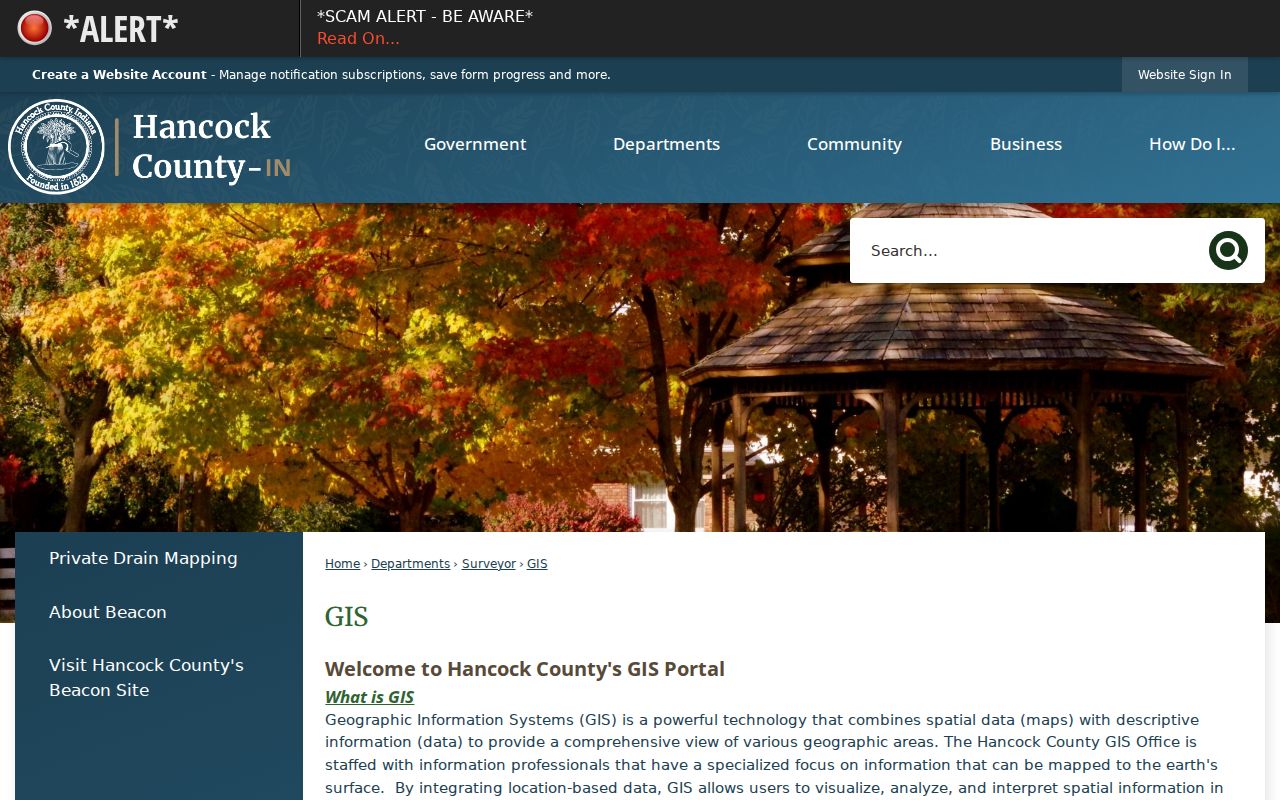
That county page also supplies GIS office contacts and the legal-boundary warning that should travel with every saved map.
Greenfield Street Record Terms
Small field differences matter on a Greenfield block. The public parcel layer exposes both property and owner-mailing fields, as well as old parcel numbers, legal descriptions, last-transfer data, and geometry. Record them separately.
- Parcel
- A county-tracked unit of land identified by a parcel ID.
- Situs address
- The physical property location, which may differ from where tax mail goes.
- Legal description
- The lot, tract, or metes-and-bounds wording used to identify land in a recorded instrument.
- Plat
- A recorded drawing that defines lots, blocks, easements, or a subdivision.
- Criss-cross directory
- A directory arranged by address or street rather than only by surname. Reverse capability varies by volume.
The distinction is a strong Greenfield address-record safeguard. A parcel owner can live elsewhere, a mailing address can identify only tax correspondence, and a legal description can remain stable even when an ordinary street label changes.
Browse Greenfield Parcels by Street
Beacon has no documented button that automatically lists every address on a road. Start at one confirmed parcel, then pan and select each adjacent polygon. The white arrow or square selects a feature, the blue information icon identifies it, and the ruler measures approximate distance. Zoning, flood, voting district, landmark, and other thematic layers add civic context.
The direct Hancock parcel map provides the practical street view.
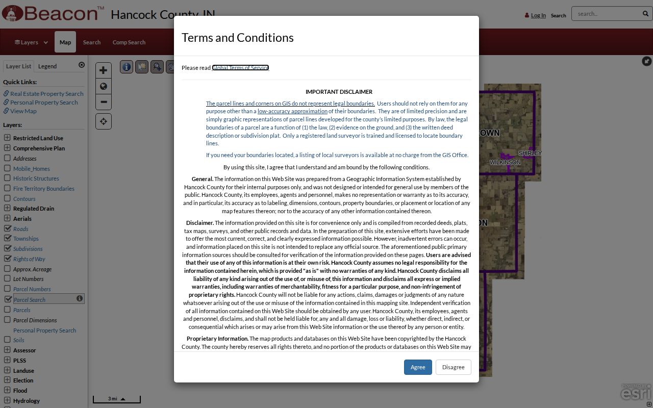
Save the query date and parcel ID with each observation. A shared edge on this map shows spatial context, not a surveyed boundary or proof of occupancy.
Technical users can query the public ArcGIS parcel service by street, city, ZIP, and other address fields. It supports filtering, statistics, pagination, and geometry, with a maximum record count of 2,000. Narrow fields and paginate rather than treating one response as a full Greenfield by-street record.
Fields Behind Greenfield Street Maps
The Hancock parcel REST layer reveals the structure beneath the public map.
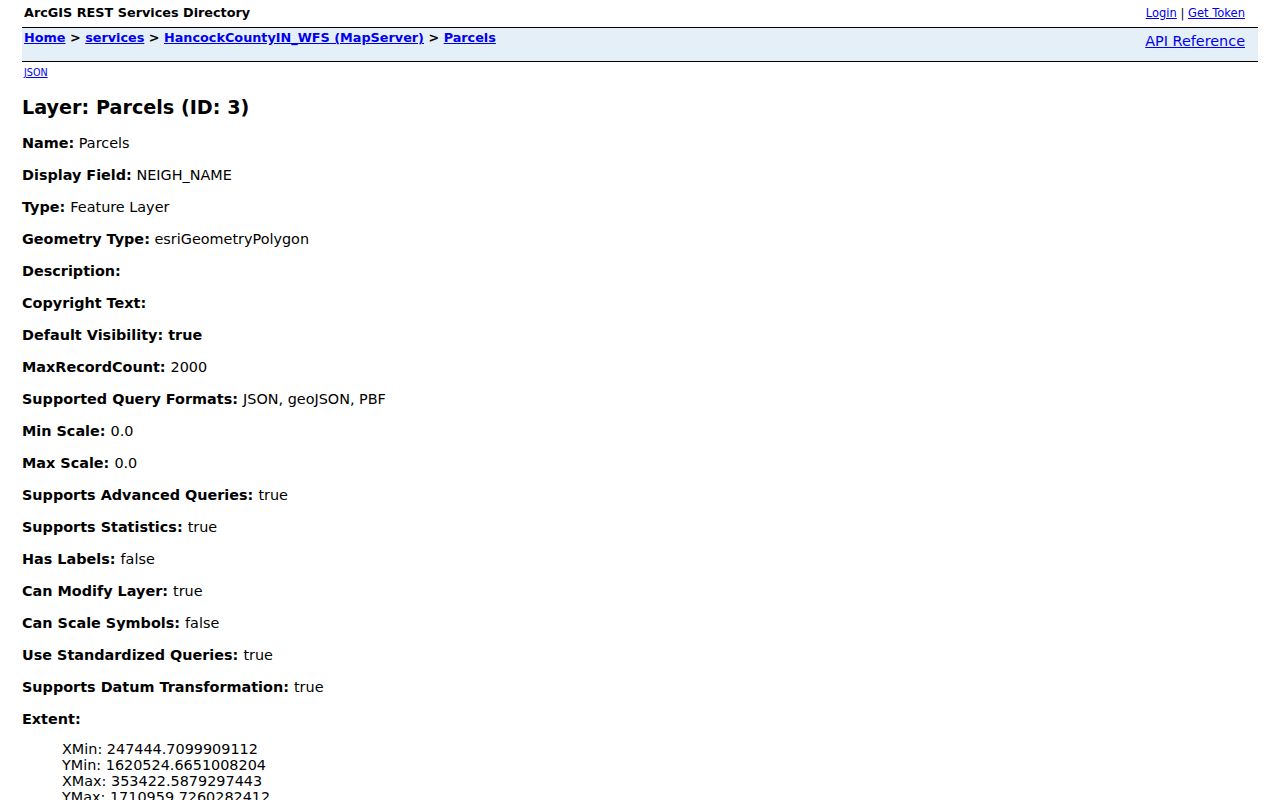
The layer includes parcel ID, property street, city and ZIP, owner and mailing fields, legal description, last transfer, neighborhood, old parcel number, street components, and geometry. Not every raw field appears on a Beacon card.
A sample query filtered to Greenfield returned distinct rural and city-style addresses, including a county-owned exempt parcel and parcels classified as agricultural or residential. That variety warns against assuming every Greenfield mailing label represents an incorporated-city household. It also shows why street direction, number, and municipality must stay in the worksheet.
Note: A three-row parcel sample illustrates record fields, not the whole street, neighborhood, or city.
Greenfield Street Directory Sources
Address-keyed sources overlap, but none replaces another. The assessment roll is current ownership evidence. Recorder instruments document transactions. City permits show property activity, and dated print sources can name past occupants. Use the access route and caveat beside each source.
| Record Set | Keeper | What It Shows | Access |
|---|---|---|---|
| Assessment record | Hancock County Assessor | Current owner, parcel, physical and mailing address context | Free Beacon search; current data |
| GIS parcel map | Hancock Surveyor/GIS | Adjacent parcels and public map layers | Free viewer; not a legal survey |
| Deeds, liens, plats | Hancock County Recorder | Recorded parties, dates, legal description, title chain | Doxpop from January 1968; counter, mail, books for fallback |
| Transfers and disclosures | Hancock County Auditor | Parcel transfer and sales-disclosure events | Public disclosures from January 2000; office help available |
| Permits and planning | Greenfield Planning | Address or parcel-linked applications and cases | CitizenServe plus department request; online start not stated |
| Named voter check | Indiana Voters / Hancock Elections | Registration, polling and district match for a known person | Individual search only; no public street roster |
| Historical directories | Hancock County Public Library | Dated occupant and address lines | Library room, scans, staff help; reverse arrangement varies |
When an online source fails, call or visit the correct custodian. The Assessor is at 317-477-1102 and GIS at 317-477-1150. The Recorder counter is open weekdays from 8 to 4 at 111 S American Legion Place, Suite 202, and accepts mailed deed-copy requests with payment and a postage-paid return envelope. Older tax microfilm and historical sources require the Recorder office, library, or Indiana State Library.
Trace Deeds Along Greenfield Streets
The parcel ID and legal description lead from Beacon to the Hancock County Recorder. Doxpop supplies remote grantor and grantee indexing and images from January 1968. A grantor gives an interest away; a grantee receives it. Search a person in both roles, match the legal description, and record the instrument number and recording date before stepping back to the prior deed.
The Hancock County Recorder page is the official office route.
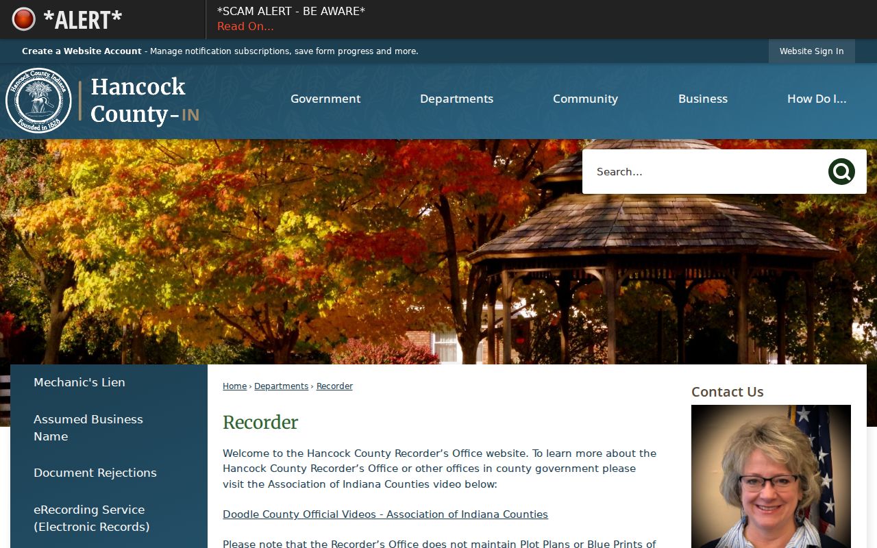
That office maintains deeds and subdivision plats, but not plot plans or blueprints. Staff cannot conduct a title search or give a legal opinion. Copies cost $1 per page, and older material may require books, microfilm, the counter, or a written request.
The February 2026 vendor announcement says all Hancock document-type indexes from 1968 became remotely available around the clock. That expands access, not historical coverage. The county's 2025 total of 14,911 recorded documents also measures transactions, not unique Greenfield people or parcels.
Greenfield Permits and Voter Clues
CitizenServe searches by File Type, Address, or Parcel Number. A hit may identify a permit, planning petition, or code matter, but the named person may be an applicant, contractor, agent, owner, or public body. The portal does not state the start of its history or expose every file option in the research capture. Call Greenfield Planning at 317-477-4320 or make a focused APRA request when the online result is unclear.
Indiana Voters works in the other direction. It asks for a known first name, last name, date of birth, and current registration county, then may confirm status, polling place, and district information. It does not accept a street and return all voters. Hancock Elections, 9 E Main Street, Room 227, handles counter, phone, mail, fax, email, and permitted form-based requests.
Protected Address Confidentiality Program records are withheld, and full voter files have purchaser and use limits under Indiana law. A no-match can reflect spelling, birth date, county, inactive status, or protection. It is not proof that a person left Greenfield.
Match Old Greenfield Street Names
No official street-renumbering year or formal reverse-directory run was found for Greenfield. Do not silently force an old address into today's grid. Pair the original directory image with plats, deed legal descriptions, city maps, and the modern parcel layer. The local landmarks in those sources include the US 40 and National Road corridor, State, Main, Apple, Blue, Meridian, Franklin, McKenzie, Park Avenue, and Brandywine references.
The Hancock County Public Library's Local History/Genealogy Room holds city directories, maps, newspapers, census tools, WPA indexes, and cemetery sources. Its Greenfield room is open seven days on the posted schedule, and readers may book a librarian. Newspaper microfilm spans the Hancock Democrat/Journal, Hancock Republican, and Daily Reporter, but most years are not fully indexed.
For the directory shelf and how to read a dated entry, use the Greenfield city directories resource. A street record should retain the volume year, exact printed address, and spelling seen in the image.
A compact worksheet prevents false joins across nearby parcels. For each address, record the exact street spelling and direction, property ZIP, parcel ID, physical address, owner mailing address, legal description, old parcel number if present, last-transfer date, and selected map layers. Add the Doxpop instrument number, date, and party roles. Label each permit or directory entry by file or year.
The property ZIP and owner ZIP answer different questions. A Greenfield mailing label can fall beyond incorporated limits, while a parcel owner can receive tax mail far from the property. Check USPS address results, Beacon jurisdiction fields, and city annexation or UDO maps rather than treating ZIP 46140 as a city boundary.
For a whole street, paginate the parcel service and note the query date. Exempt lots, rural routes, old parcel numbers, and legal-description-only results require follow-up through plats and Recorder records. Never infer a complete street from a handful of sample rows.
Limits of Greenfield Street Records
A Greenfield street directory cannot name every person at an address. Assessment and deed records identify property interests, not a complete household. Public systems do not supply utility customers or private delivery data. Federal law restricts motor-vehicle address information, and sealed court or vital material stays outside an ordinary address search.
Indiana's Address Confidentiality Program uses a secure substitute address for eligible survivors. Voter and other government records can therefore omit the confidential location. Do not try to defeat that protection. If an official parcel record appears wrong, send the exact parcel or instrument ID and supporting proof to the Assessor, GIS office, Recorder, or other source custodian.
Lawful use. Greenfield address records support family history, civic research, fraud checks, and other lawful personal work. Never use them to monitor, threaten, harass, or harm a person.
Suspicious deed mail should be checked with the Recorder at 317-477-1142. Hancock's Property Alert can notify a subscriber when a matching name or legal description appears, but an alert cannot prevent a properly formatted filing. If conduct becomes threatening, preserve messages and contact 911 for immediate danger or Greenfield Police at 317-477-4400 for non-emergency help.